Drone photography to sell land and property in Punta Cana.
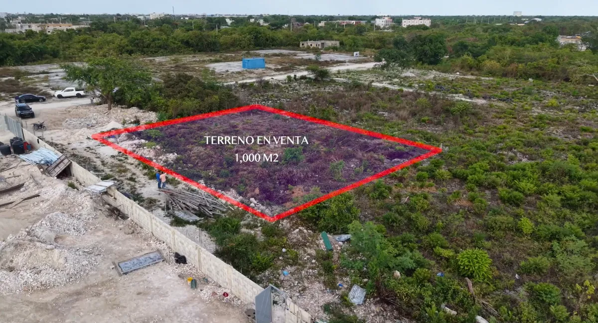
A lot sells better when buyers understand where it is and what's around it. With aerial photos and video we show the surroundings, the access roads and the true potential of the place.
- Report within 72 hours
Aerial real estate
Who it's for
Owners, real estate agents and developers selling land, villas or projects in Punta Cana, Bávaro, Cap Cana and nearby areas.
Especially useful when buyers are overseas and decide based on a listing: aerial shots answer questions like “what's around it?” or “how far is the beach?” in seconds.
What's included
Aerial photos
Top-down and angled shots that show boundaries, shape and surroundings.
Aerial video
Fly-throughs that place the property relative to beaches, roads and amenities.
Ready-to-publish files
Edited and sized for listing portals, social media and WhatsApp.
Delivered within 72 hours
By email, WhatsApp or download link.
Aerial real estate photography & video
How it works
Send us the location
And tell us what you want to highlight about the property.
We plan the shots
Time of day, angles and flight path for that property.
We fly
We capture photos and video in a single visit.
You get the files
Edited and ready to publish within 72 hours.
Common questions
Frequently asked questions
Does it work for vacant land?
Yes — that's where it helps most. From the air you can understand the shape, size and surroundings of a lot, which is hard to see from the ground.
Can I use the photos on listing sites and social media?
Yes, the footage is delivered for you to use when promoting that property.
What if it's cloudy that day?
If the weather doesn't allow good shots, we reschedule.
Do you work with real estate agents?
Yes, we work with owners, agents and developers alike.
Let's talk
Show your property the way it deserves.
Send us the location and we'll tell you how we'd shoot it.